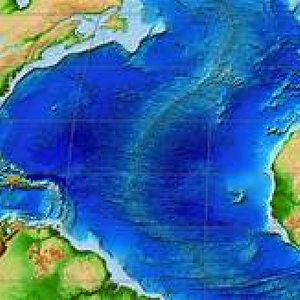
Mapping the Ocean Floor
Ozobot
4-5
•
Engineering/Tech, Science
•
saved
Students will create models of the ocean floor with QR codes associated with each feature. Students will then switch maps of the ocean floor and use Ozoblockly to code the path drawn by another group.
Ozobot Blockly
Academic Standards
CSTA.1A-AP-08, ISTE.5.c
Resources
Explore more lessons


Loading Document...